 Available
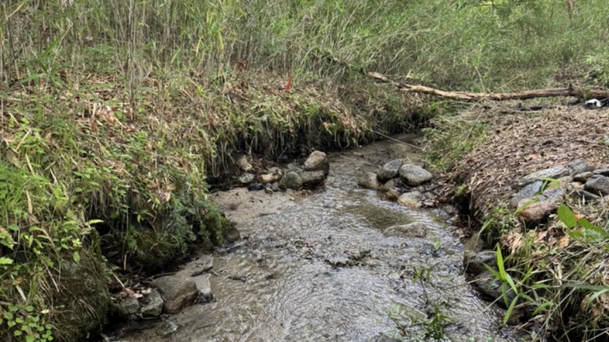
The Kurosawa River flows through the site. The catchment area of the upstream is about 75ha. Photographed in October 2026.
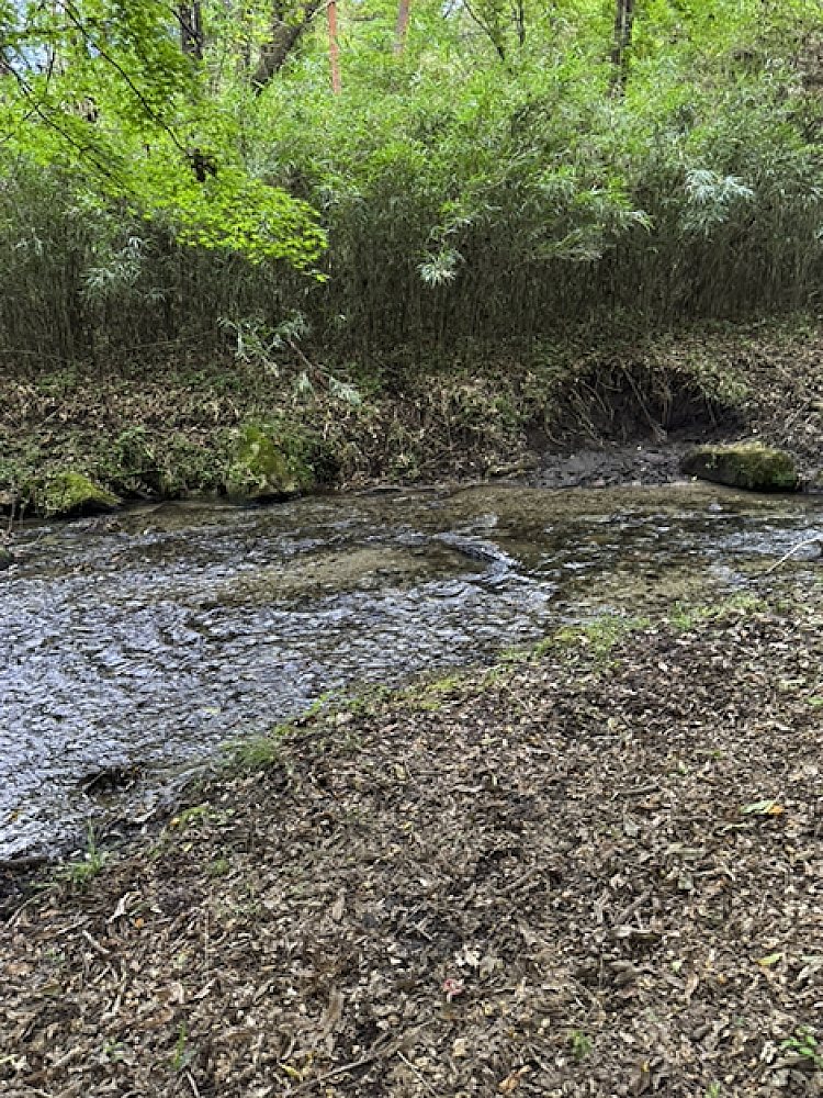
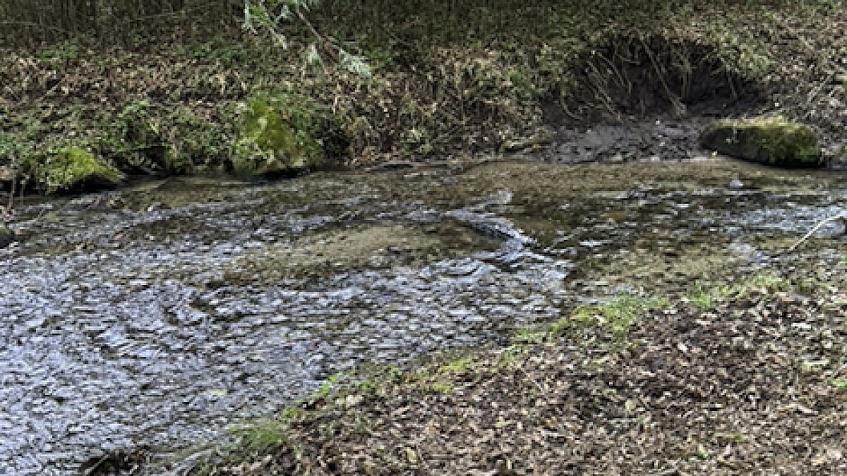
Hokuto Shi Takekawa Machi Yanagisawa (北杜市武川町柳澤), Yamanashi Mountain forest with a stream flowing 52m inside the property (2 parcels, 10,885㎡)
We start with the limitations. The slopes are steep. The median slopes are 20° and 28°. Even the parcel with the larger continuous gently sloping area has only 510㎡ of it. Of the 10,885㎡, only a small part can be used as a flat. Also, road access is not adjacent to a road that can be used from the outside in the decision on the desk (1 parcels is adjacent to the road, but it is "close" in the decision except for the inner road). According to the official river data, the site is adjacent to the Kurosawa River at a distance of 0, and there is a possibility that the permission of the River Law is required for the installation of works and the modification of the land in the part corresponding to the river area. We have not yet verified this. Please also verify this yourself before entering into a contract. Protected-forest designation and erosion-control area designation have not yet been verified either. With those limitations stated, here is what we have verified. The stream crosses 1 of the 2 parcels by 52m and flows along the parcel boundary of the other 1 parcel. The catchment area of the upstream is about 75ha. The SAWA score of both parcels is 90, which is the highest among the parcels analyzed by our company. Neither landslide hazard warning zone nor flood inundation assumption zone are included.
- Price
- ¥9,950,000 (approx. 2.690 acres) Land transfers are exempt from consumption tax (Consumption Tax Act, Article 6, paragraph 1; Appended Table 2, item 1). The displayed price is without tax.
- Location
- Yanagisawa, Mukawa, Hokuto, Yamanashi (山梨県北杜市武川町柳澤)
- Area
- 10,885㎡(approx. 2.690 acres)/2 parcelsThe total plot area of 2 parcels (calculated from the coordinates of the map provided by the register office) is 10,884.7㎡. Sometimes, the registered land area does not match the land area due to the extension and contraction of the rope.
- Land category
- Forest
- Stream relation
- Stream runs through the property(53m)
- Flat ground
- approx. 510㎡
- Distance to road
- approx. 11m
- Road access
- A 4.2m wide carriageway adjoins 1 parcels, but both parcels are "close" in the judgement except for the station road and private road (the other 1 parcels is 10.6m). If it is adjacent to a road that can be used from the outside, it is necessary to verify it on site and in the cadastral map.
- Utilities
- Electricity is supplied by Tokyo Electric Power Grid (the existence of the drawing and the distance of the drawing are not confirmed). There is no public water supply. To get drinking water, it is necessary to dig a well. There is no sewer, and the drainage is treated individually.
- Hazard zones
- Landslide alert zone within 467m This is not a guarantee that the land lies outside any zone. Result of matching each parcel's representative point against MLIT Real Estate Information Library data. The check uses each parcel's representative point, not the whole parcel. Near a zone edge, part of the same parcel can fall inside it. Confirm designations against the municipality's hazard map.
- Building conditions
- The entire area of Hokuto City is outside the urban planning area and has no use area, and there is no designation of roads under Article 42 of the Building Standards Act (source: Hokuto City ). Therefore, the road access obligation of Article 43 of the Act is not applicable. But the next one is unconfirmed. (1) The site is deemed to be at a distance of 0 from the Kurosawa River according to the official river data, and in the part corresponding to the river area, permission under Articles 24 to 27 of the River Law (occupation of land, extraction of earth, construction of new works, excavation of land, etc.) may be required. It is uncertain whether the administrator is from Yamanashi Prefecture or Hokuto City. (2) The corresponding erosion-control designated area is not confirmed (there are areas related to debris flow such as Sanharazawa and Ohira in the vicinity). (3) The designation of the protected forest is not confirmed. If there is a designation, the Forest Act requires permission for the felling of standing trees and the modification of the land. According to the Hokuto City Town Planning Ordinance, buildings of more than 10 square meters must be submitted to the city by 30 days prior to the start of construction, and the criteria such as building coverage ratio and minimum land area vary according to the area division. (5) The actual size of the building is limited by the slope first.
- Points to note
- We are the seller. As we are not a real estate brokerage business, we do not do mediation, agency, or statutory disclosure of important matters. / The area is the sum of 2 parcels calculated on the chart, and may not match the registered area. The sale based on registered area and the sale based on measured area are agreed upon before the contract is signed. In the water source area of the Yamanashi Prefecture groundwater and regulation on the preservation of water source area. Contracts for the sale and purchase of land must be submitted to the governor by 30 days before the contract is concluded (Article 22 of the same regulation). The application of river law, sand protection law, and Forest Act (protected forest) is not confirmed. Please check yourself before you sign the contract. The boundary was not determined. The parcel boundary is not undefined (according to 14 maps).
- Seller
- FocusFirstAdvisors Co., Ltd.
- Terrain analysis
- Analysed The parcels were identified by lot number and analysed with SAWA. The stream relationship, upstream catchment, slope and contiguous gentle-slope area are all analysis outputs, computed from the Article 14 registry map and airborne lidar terrain data. Road access and hazard zones are desk assessments, not legal determinations.
Steep slopeLarge areaOutside city planning areaNo mains water
Boundary survey, groundwater volume and quality, whether building is permitted, winter access. None are confirmed. If you visit, we will tell you exactly what is known at that point.
Please verify. Listing details come from the lister and include estimates derived from terrain data. Year-round flow, boundaries, water rights, road access and development feasibility must be verified on site and with the lister. This site makes no claim about future value or usability. We are not a licensed real estate broker and act neither as agent nor intermediary. Enquiries go directly to each lister.
SAWA analysis
(stream relation, length, catchment, slope, flat ground, sunlight and hazard zones)
This is not information entrusted to us by a lister. Sawa Bank's operator, FocusFirstAdvisors Inc., owns this land. We show it separately so that its position at the top of the site is not read as an editorial judgement.
We are the seller. We are not a licensed real estate broker in Japan, so we do not act as agent or intermediary and we do not give the statutory explanation of important matters. If you need that explanation, or want a third-party professional to check the land, please instruct a licensed broker or a judicial scrivener. Costs are negotiable.
Site and analysis last confirmed: 2026.10.06