 Available
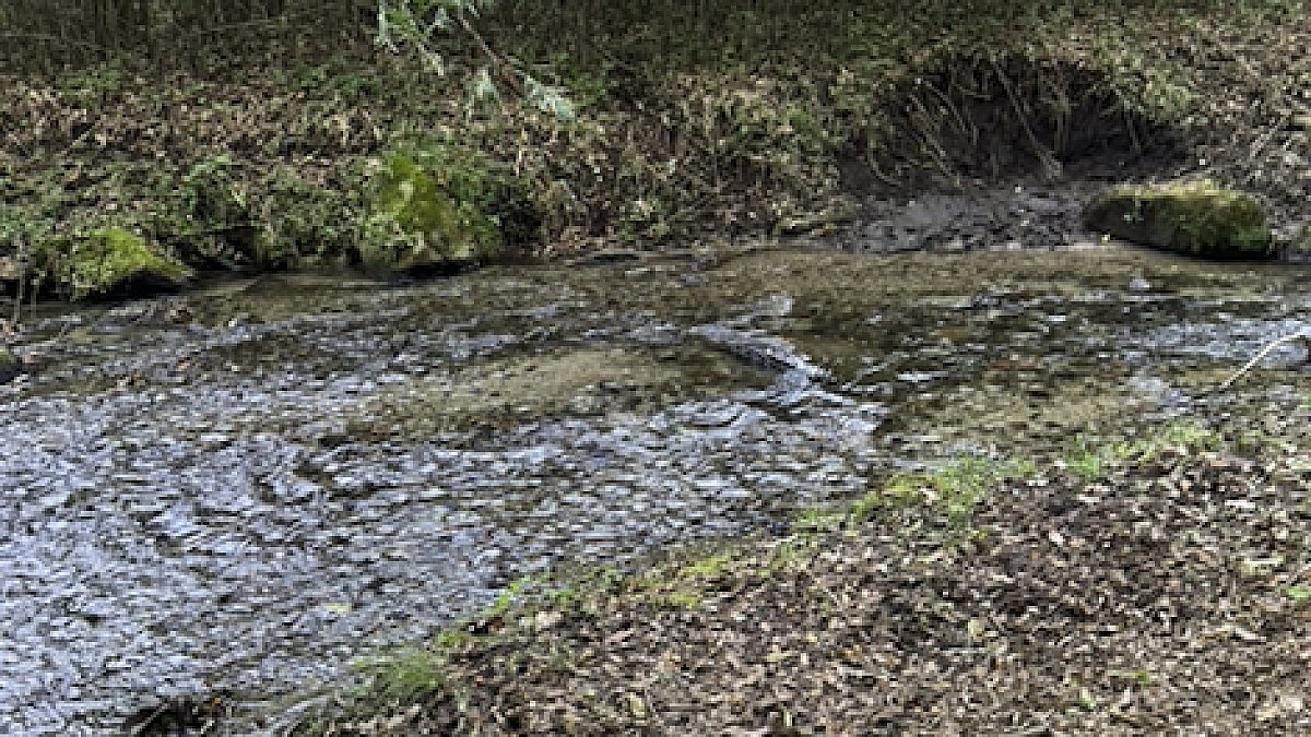
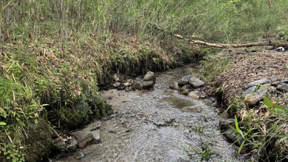
A stream passing through the east side of the site. The catchment area of the upstream is about 40ha. Shot in the summer of 2026.
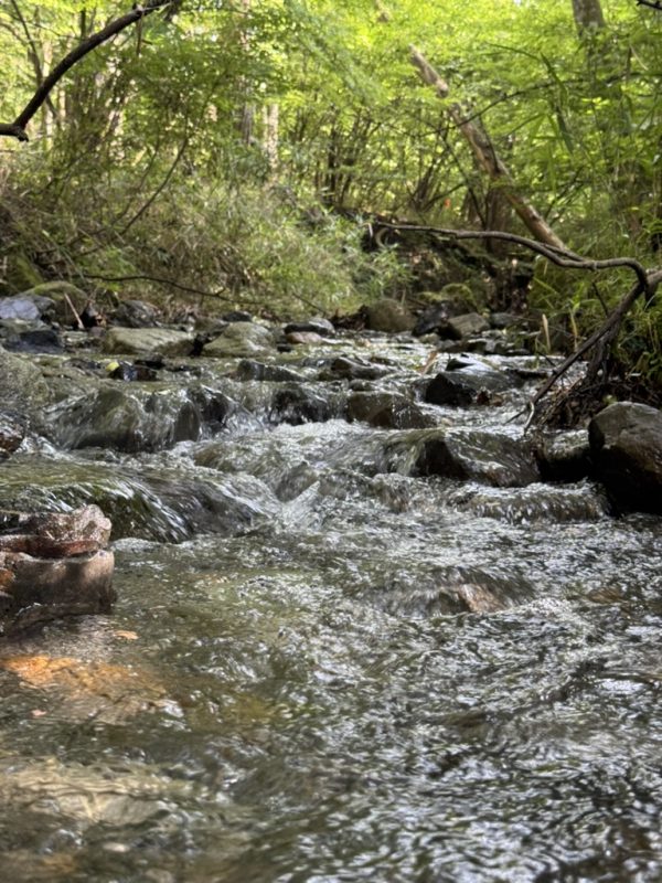
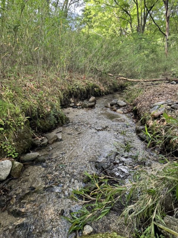
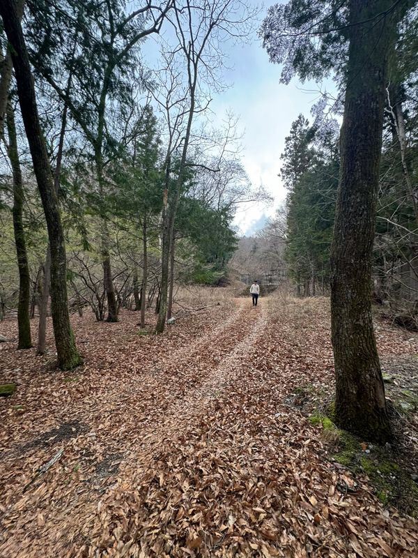
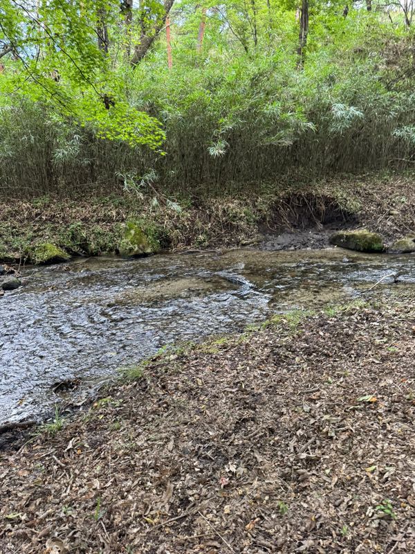
Hokuto Shi Takekawa Machi Yanagisawa (北杜市武川町柳澤), Yamanashi Mountain forest with a stream flowing through the property (4 parcels, 2,561㎡)
One of the four parcels has no road access, and the remaining three parcels have road access. It is possible that one of the waterways crossing the site has an upstream catchment area of only 0.06 ha and is only a post-rain flow. The stream in the photograph is the stream on the east side of the catchment area of about 40ha. With those limitations stated, here is what we have verified. There are 4 parcels with a total of 2,561㎡ (area shown in the diagram), an average slope of 6 degrees, and the largest parcel has a continuous soft hillside of 653㎡. Neither landslide hazard warning zone nor flood inundation assumption zone are included.
- Price
- ¥4,950,000 (approx. 0.633 acres) Land transfers are exempt from consumption tax (Consumption Tax Act, Article 6, paragraph 1; Appended Table 2, item 1). The displayed price is without tax.
- Location
- Yanagisawa, Mukawa, Hokuto, Yamanashi (山梨県北杜市武川町柳澤)
- Area
- 2,561㎡(approx. 0.633 acres)/4 parcelsThe total plot area of 4 parcels (calculated from the coordinates of the map provided by the registration office) is 2,560.9㎡. Sometimes, the registered land area does not match the land area due to the extension and contraction of the rope.
- Land category
- Forest
- Stream relation
- Stream runs through the property(24m)
- Flat ground
- approx. 653㎡
- Road access
- 1 parcels have no road access. The remaining three parcels have road access. 1 parcels are adjacent to 1.8m long narrow road and waterway, but the land number is unknown and the rights relationship is not confirmed.
- Utilities
- Electricity is supplied by Tokyo Electric Power Grid (the existence of the drawing and the distance of the drawing are not confirmed). There is no public water supply. You have to dig a well to get drinking water. The excavation cost varies depending on the depth and geology, and as a general guideline, it is estimated to be about 1.5 million yen (including pumps) for a depth of 40 meters, but this is not an estimate for this land. The water from the stream is drawn for domestic use, but not for drinking. There is no sewer, and the drainage is treated individually.
- Hazard zones
- Landslide alert zone within 217m This is not a guarantee that the land lies outside any zone. Result of matching each parcel's representative point against MLIT Real Estate Information Library data. The check uses each parcel's representative point, not the whole parcel. Near a zone edge, part of the same parcel can fall inside it. Confirm designations against the municipality's hazard map.
- Building conditions
- The entire area of Hokuto City is outside the urban planning area and has no use area, and there is no designation of roads under Article 42 of the Building Standards Act (source: Hokuto City ). Therefore, the road access obligation of Article 43 of the Act is not applied, and construction is allowed. However, the following procedures and restrictions apply. (1) According to the Hokuto City Town Planning Ordinance, new construction of buildings (including garages, storage buildings, and agricultural warehouses) of more than 10 square meters must be submitted to the city by 30 days prior to the start of construction. (2) The criteria of building coverage ratio 40〜60%, floor area ratio 80〜200%, minimum land area 300〜1,000㎡, greening rate 10〜25% or more, maximum height 10〜15m, wall retreat 2〜5m or more are changed by the zone division (Ⅰ, Ⅱ, Ⅲ) of the same regulation. Please check the area map of the city to see which area this land belongs to (this is not confirmed by our company). (3) The Hokuto City Landscape Ordinance applies to the entire city. (4) Whether an application for building approval is required or not depends on whether the building is in the governor's designated area under Article 6, Paragraph 1, No. 4 of the Building Standards Act (this is not confirmed by our company). (5) The actual size of the building is restricted by the terrain before the building coverage ratio. The largest parcel with a continuous soft slope is 653㎡. (6) Wastewater treatment tank is required separately because there is no public water supply, well, and sewerage. We also need to improve the access road.
- Points to note
- We are the seller. As we are not a real estate brokerage business, we do not do mediation, agency, or statutory disclosure of important matters. / The area is the sum of 4 parcels by graphical calculation, and may not match the registered area. The sale based on registered area and the sale based on measured area are agreed upon before the contract is signed. In the water source area of the Yamanashi Prefecture groundwater and regulation on the preservation of water source area. Contracts for the sale and purchase of land must be submitted to the governor by 30 days before the contract is concluded (Article 22 of the same regulation). The boundary was not determined. The land was as registered. The parcel boundary is not undefined (according to 14 maps).
- Seller
- FocusFirstAdvisors Co., Ltd.
- Terrain analysis
- Analysed The parcels were identified by lot number and analysed with SAWA. The stream relationship, upstream catchment, slope and contiguous gentle-slope area are all analysis outputs, computed from the Article 14 registry map and airborne lidar terrain data. Road access and hazard zones are desk assessments, not legal determinations.
3 parcels road access ・1 parcels no road accessHas flat groundLarge areaOutside city planning areaNo mains water
Boundary survey, groundwater volume and quality, whether building is permitted, winter access. None are confirmed. If you visit, we will tell you exactly what is known at that point.
Please verify. Listing details come from the lister and include estimates derived from terrain data. Year-round flow, boundaries, water rights, road access and development feasibility must be verified on site and with the lister. This site makes no claim about future value or usability. We are not a licensed real estate broker and act neither as agent nor intermediary. Enquiries go directly to each lister.
SAWA analysis
(stream relation, length, catchment, slope, flat ground, sunlight and hazard zones)
On-site measurements
This is the value measured once in the field on September 22, 2026. The difference with the outside air temperature was 12.9℃. Since it is a single measurement, it does not indicate the water temperature throughout the year or that this water temperature is maintained in the summer. It varies according to the season and the weather.
This is not information entrusted to us by a lister. Sawa Bank's operator, FocusFirstAdvisors Inc., owns this land. We show it separately so that its position at the top of the site is not read as an editorial judgement.
We are the seller. We are not a licensed real estate broker in Japan, so we do not act as agent or intermediary and we do not give the statutory explanation of important matters. If you need that explanation, or want a third-party professional to check the land, please instruct a licensed broker or a judicial scrivener. Costs are negotiable.
Site and analysis last confirmed: 2026.10.01