Skip to content
Home / Mukawa streamside land
Supplied site diagram · parcel numbers withheld. This is a reference diagram, not a surveyed boundary.

A–H on the diagram match the parcel details below. These are reference labels, not parcel numbers. Lines point to the narrow parcels.

LAND FOR SALE · HOKUTO

All 8 parcels owned by Sawa Bank

Streamside land and woodland in Mukawa, Hokuto.

Eight parcels offered together. Review the supplied site diagram and terrain analysis before enquiring.

Parcel D has been acquired; registration of the ownership transfer is pending.

Approx. price56,220USD

Asking price: JPY 8,950,000 (approx. USD 56,220). Converted at USD 1 = JPY 159.195, the midpoint of the Bank of Japan quote at 17:00 JST on 20 Nov 2026. Please confirm the exchange rate and final payment amount via WhatsApp or email. Exchange-rate source: Bank of Japan

Location
Mukawa, Hokuto City, Yamanashi Prefecture (parcel numbers withheld)
Registered area in supplied records
8,186 m² across 8 parcels.
Reference map area
8,151.7 m² across 8 parcels (SAWA map calculation)
Land categories
Undeveloped land and woodland. Parcel D is undeveloped land (61 m²).
Surroundings
No homes within 100 m.
Electricity
Tokyo Electric Power (TEPCO)
Construction
Construction possible
Contact us on WhatsApp

Overseas enquiries welcome via WhatsApp or email. Ask about the location, viewings and payment details.

INTERNATIONAL BUYERS WELCOME

Your place beside a Japanese stream.

Sawa Bank welcomes enquiries from overseas. Foreign nationals can generally purchase and own land in Japan, subject to the requirements for each property and transaction. Start by exploring the land and telling us what you have in mind.

Ownership you can plan for

Japan has registration procedures for foreign owners living abroad. Check the required documents and any property-specific approvals with a judicial scrivener or other qualified professional.

Explore from wherever you are

See this property’s photographs, video, parcel diagram and terrain analysis before arranging a visit. Compare the landscape with the way you hope to use it.

A direct conversation

Email or message Sawa Bank about this featured land. Tell us your intended use, country of residence and questions, and begin gathering the information for your decision.

Plan the purchase and the intended use together: registration, notifications, building and water-use conditions need individual checks. Property ownership does not itself grant a visa or residence status.

Photos of the site

Select a photo to see it in full size.

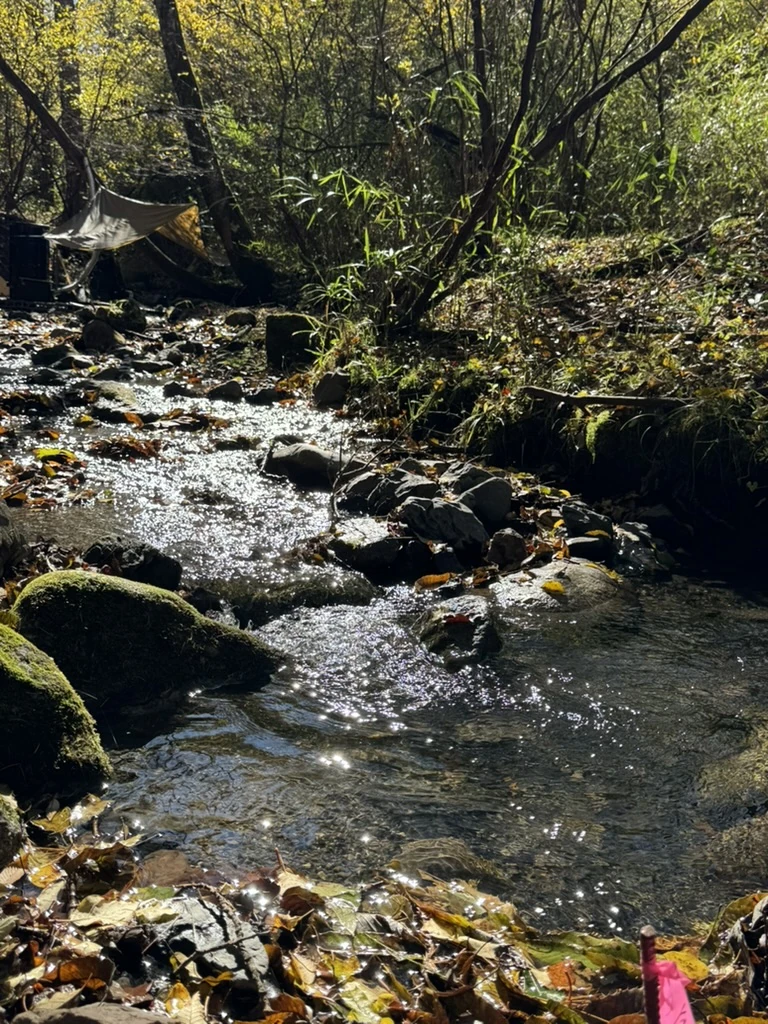
A stream flowing between rocks beneath sunlit trees
Sunlight on the stream.
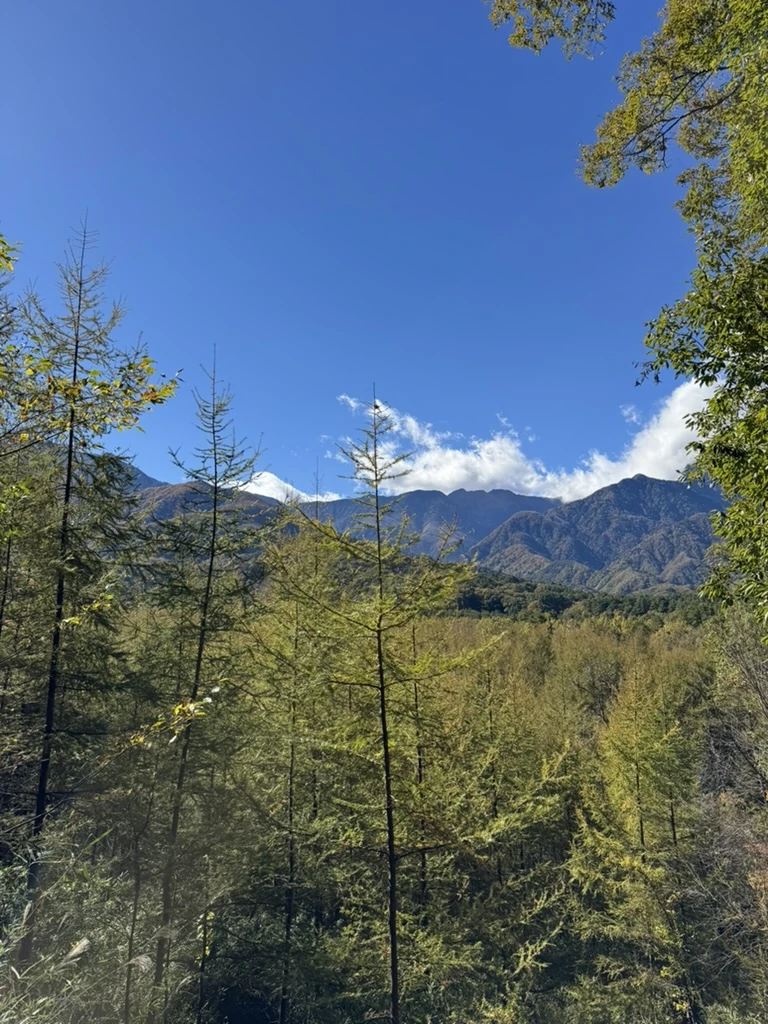
Mountain ridges and trees beneath a blue sky
Blue sky, mountains and surrounding trees.
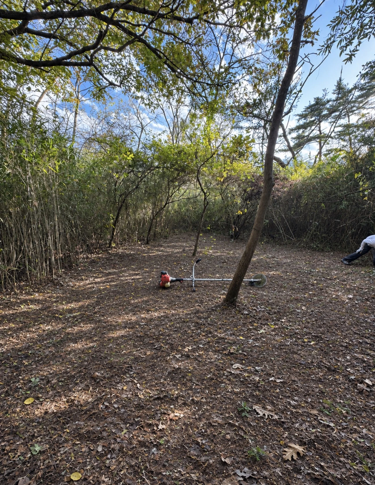
A leaf-covered woodland floor with a brush cutter and a person working at the edge
The woodland floor and clearing work.

A cabin, tools, outdoor bath and tent sauna included

Facilities on the land, ready for clearing work and time in the woods. Select a photo to enlarge it.
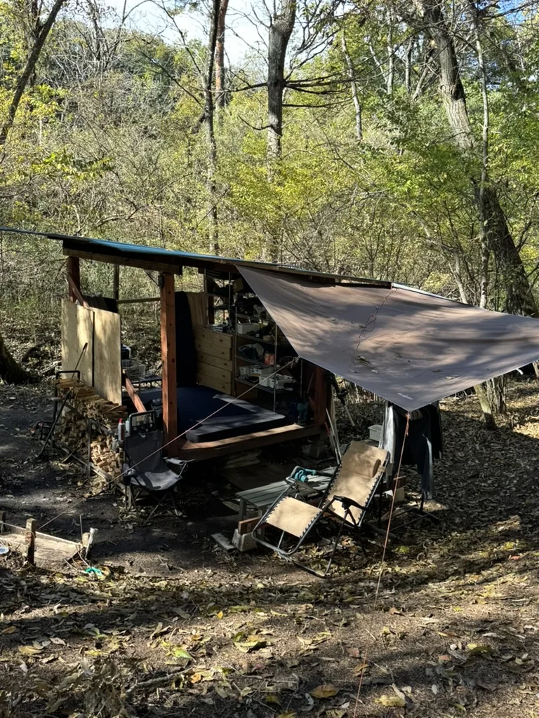
A wooden cabin with a tarp, chairs and stacked firewood in the woods

A rainproof cabin with a wood stove

A fully rainproof cabin with a wood-burning stove is included, providing a base for spending time in the woods.
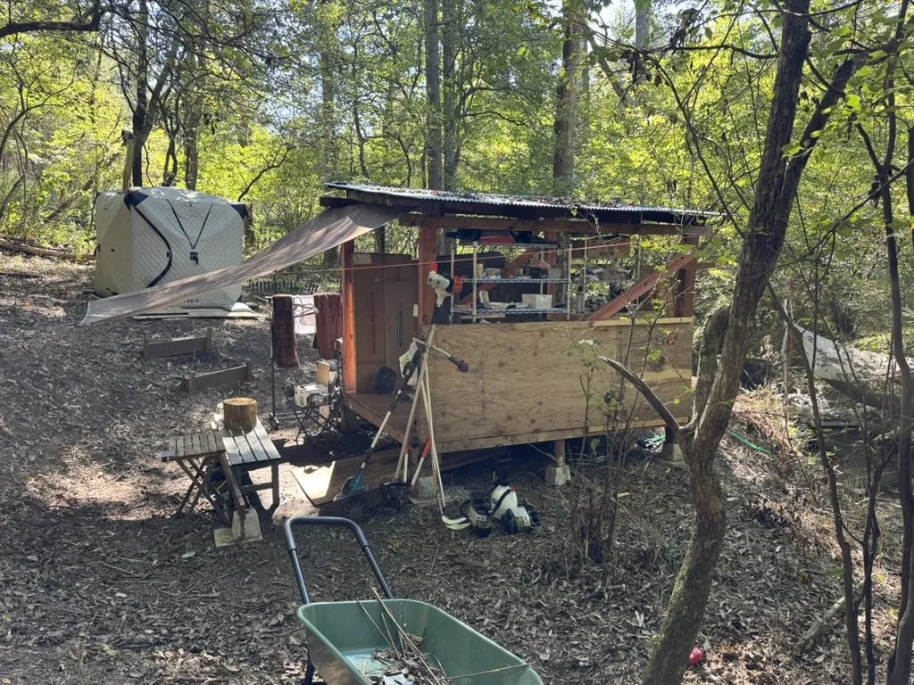
The cabin and clearing tools, including a brush cutter, viewed from the side

Tools to start clearing the land

A brush cutter, chainsaw, impact driver, blower and batteries are included, so you can start working on the land right away.
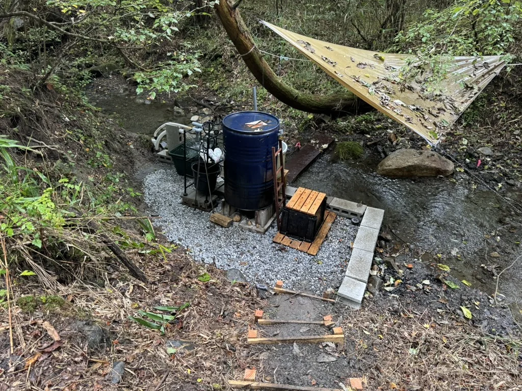
A blue barrel-style outdoor bath beside the stream, with steps and a hammock

A wood-fired outdoor bath

A traditional Goemon-style bath is included. Heat it with a fire for a hot bath, or use it unheated as a cold plunge after the sauna. It uses natural water from Mount Kaikoma.
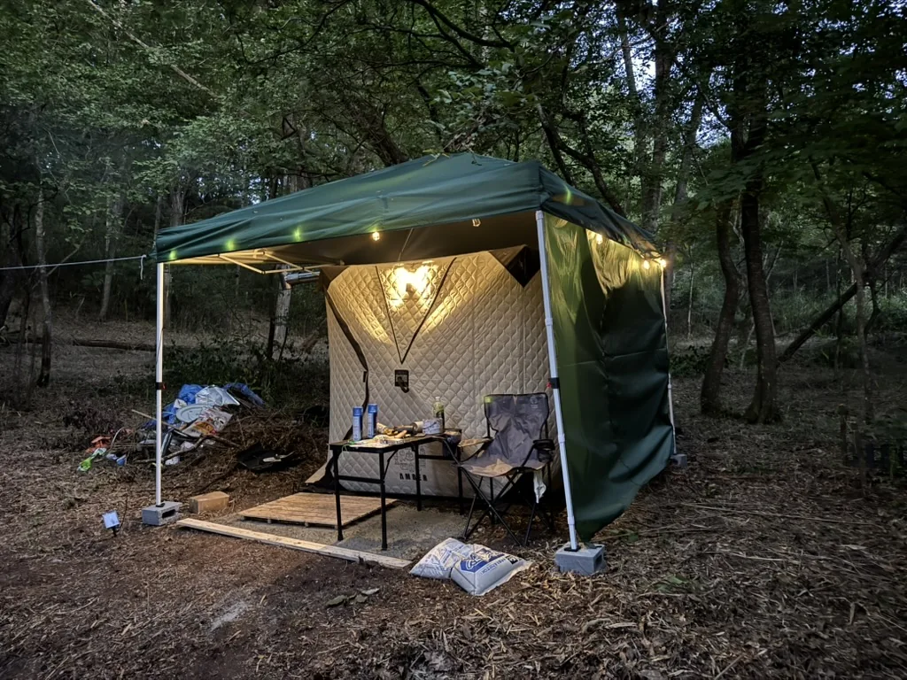
A tent sauna under a green canopy in the woods at dusk

A wood-fired tent sauna

A tent sauna that reaches over 120°C is included. Get started with firewood; the temperature varies with operating conditions.

Time spent on this land

Everyday moments with fire and water, surrounded by woodland. Select a photo to enlarge it.
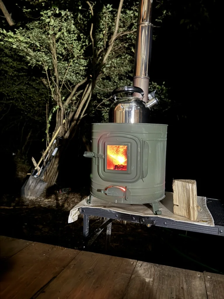
A glowing wood stove with a kettle on top in the woods at night

Warm evenings by the wood stove.

As evening falls, settle beside the wood stove and watch the flames. A kettle on top provides hot water for a warm drink. After a day of clearing the land, slow down and enjoy the warmth of the fire.
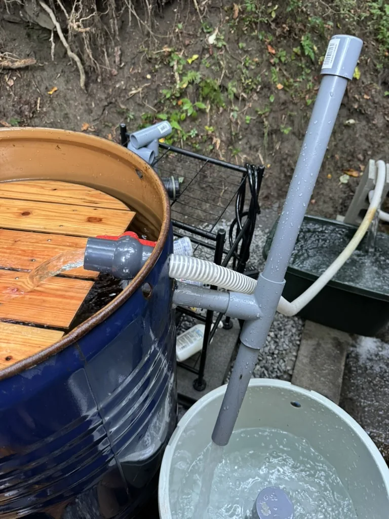
Water flowing through siphon pipes beside an outdoor bath and a compact washing machine

Endless ways to use the stream. Even a washing machine, using the siphon principle.

A siphon moves water using a difference in water levels. The photo shows a piping arrangement that brings stream water to the outdoor bath and a compact washing machine. Thoughtful water use includes keeping detergent-containing wastewater out of the stream.
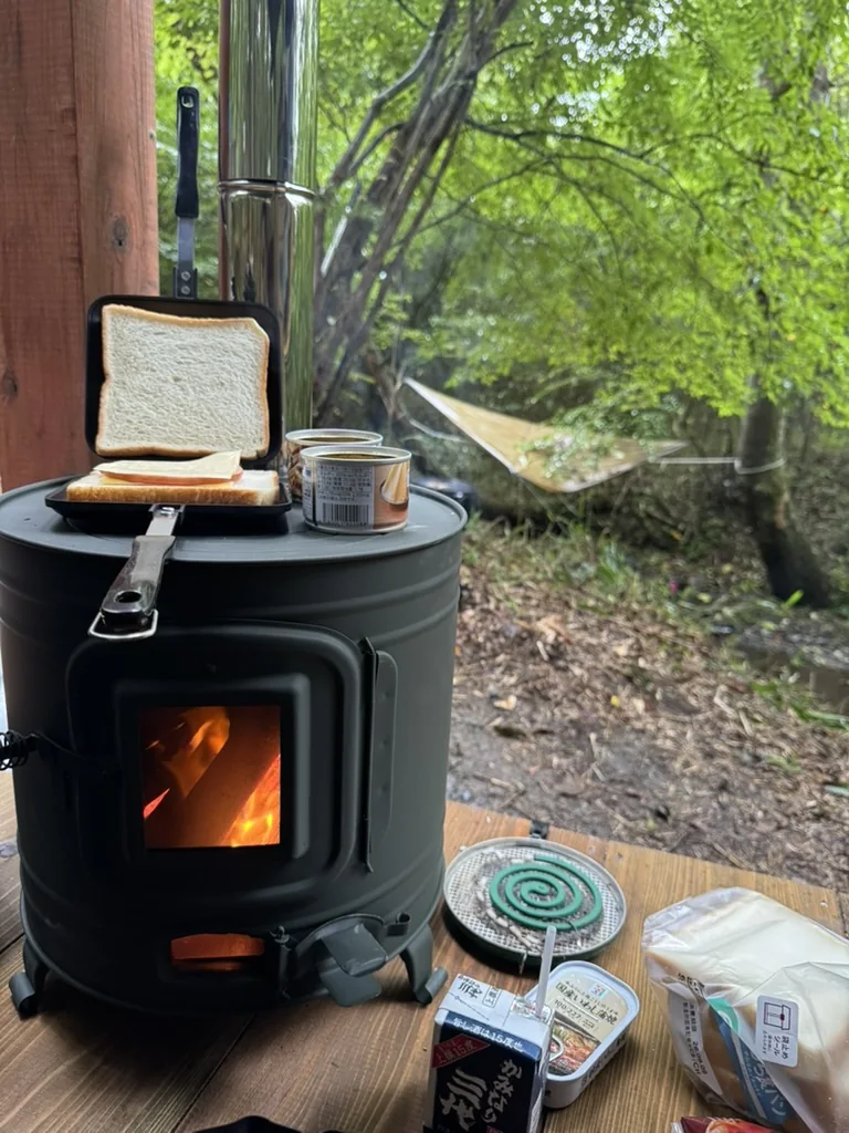
Preparing a toasted sandwich and warming canned food on a wood stove beside green woodland

Camp whenever you like.

Start the morning with a toasted sandwich on the wood stove, looking out into the green woodland. Bring out your favorite camping gear and enjoy meals and breaks at your own pace. Time spent tending the land can also be time spent camping.
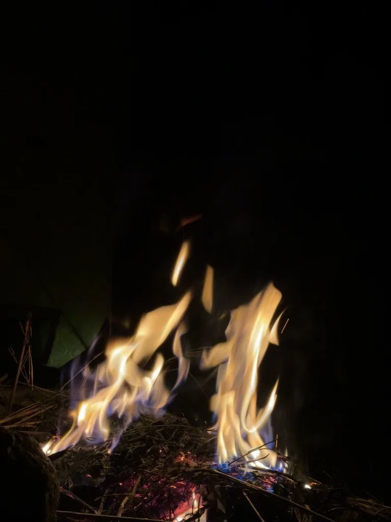
Flames and glowing embers of a campfire at night

Watch the campfire and enjoy a glass of Hokuto whisky.

Watch the flickering flames with a glass of Hokuto whisky. Listen to the stream and the crackle of firewood as the woodland settles into the night. The photo captures a campfire on the site.

FIELD VIDEO

See the stream in motion

A short video filmed at the site. Press play to watch the flowing water, rocks and surrounding woodland, with the original sound.

About 9 seconds · with sound

The stream at the time of filming. Flow varies with weather and season.

What the analysis shows

Stream relationship

3 parcels follow a predicted stream boundary; 3 touch it at a corner or tip. The other 2 are about 0.6 m from a predicted line.

Terrain

Median slopes range from 3.7° to 32.9° across the 6 analysed parcels. The largest continuous area at 10° or less within any single parcel is about 990 m².

Access from outside

The separate external-access classification is: adjoining road for 1 parcel, nearby for 1, and no adjoining road for 6. This differs from simple contact with a mapped road.

SAWA results are desktop estimates, not confirmation of year-round flow, water-use rights or legal road access. Please contact us for the conditions and procedures for your proposed building, electricity connection and water supply. Flood-risk data is unavailable in this API response; do not interpret this as absence of risk.

Area and analysis for each parcel

A–H on the diagram match the parcel details below. These are reference labels, not parcel numbers. Lines point to the narrow parcels.

Parcel AUndeveloped land

Registered area
1,859 m²
Map area (reference)
1,866.5 m²
Median slope
11.8°
Largest continuous area at ≤10°
724 m²
Predicted stream relationship
Along boundary
Predicted line inside parcel
16.7 m
Upstream catchment
71.83 ha
Mapped road contact
Nearby
External-access classification
Not adjoining
Nearest mapped road width
4.5 m

Parcel BUndeveloped land

Registered area
1,013 m²
Map area (reference)
1,006.4 m²
Median slope
3.7°
Largest continuous area at ≤10°
990 m²
Predicted stream relationship
Along boundary
Predicted line inside parcel
19.3 m
Upstream catchment
1.15 ha
Mapped road contact
Adjoining
External-access classification
Adjoining
Nearest mapped road width
3.5 m

Parcel CUndeveloped land

Registered area
435 m²
Map area (reference)
436.7 m²
Median slope
No analysis data
Largest continuous area at ≤10°
No analysis data
Predicted stream relationship
Predicted line approximately 0.6 m away
Predicted line inside parcel
No analysis data
Upstream catchment
No analysis data
Mapped road contact
Nearby
External-access classification
Not adjoining
Nearest mapped road width
3.5 m

Parcel DUndeveloped land

Registered area
61 m²
Map area (reference)
59.3 m²
Median slope
8.6°
Largest continuous area at ≤10°
18 m²
Predicted stream relationship
Corner / tip contact
Predicted line inside parcel
4.7 m
Upstream catchment
71.76 ha
Mapped road contact
Not adjoining
External-access classification
Not adjoining
Nearest mapped road width
3.5 m

Parcel EUndeveloped land

Registered area
37 m²
Map area (reference)
40.3 m²
Median slope
6.8°
Largest continuous area at ≤10°
33 m²
Predicted stream relationship
Corner / tip contact
Predicted line inside parcel
3.3 m
Upstream catchment
72.18 ha
Mapped road contact
Not adjoining
External-access classification
Not adjoining
Nearest mapped road width
3.5 m

Parcel FWoodland

Registered area
1,153 m²
Map area (reference)
1,224.7 m²
Median slope
32.9°
Largest continuous area at ≤10°
45 m²
Predicted stream relationship
Along boundary
Predicted line inside parcel
7.6 m
Upstream catchment
73.56 ha
Mapped road contact
Adjoining
External-access classification
Nearby
Nearest mapped road width
5.7 m

Parcel GWoodland

Registered area
332 m²
Map area (reference)
326.6 m²
Median slope
No analysis data
Largest continuous area at ≤10°
No analysis data
Predicted stream relationship
Predicted line approximately 0.6 m away
Predicted line inside parcel
No analysis data
Upstream catchment
No analysis data
Mapped road contact
Adjoining
External-access classification
Not adjoining
Nearest mapped road width
4.5 m

Parcel HWoodland

Registered area
3,296 m²
Map area (reference)
3,191.2 m²
Median slope
25.6°
Largest continuous area at ≤10°
0 m²
Predicted stream relationship
Corner / tip contact
Predicted line inside parcel
0.0 m
Upstream catchment
0.05 ha
Mapped road contact
Adjoining
External-access classification
Not adjoining
Nearest mapped road width
4.5 m

Source: supplied area records and diagram; SAWA parcel API retrieved 20 November 2026 (database updated 15 November 2026). Map areas are coordinate-based reference calculations, not registered or surveyed areas. The 8-parcel registered total includes Parcel D (61 m²), whose registry information was obtained on 20 November 2026. Slope, flat-area and road-width values are estimates; flat areas are not added together as one continuous usable site.
Parcel diagram A–H

Scroll horizontally or vertically to see all of the diagram. The letters match the parcel details.

Reference diagram of parcels A to H and the stream; parcel numbers withheld
← Back to the homepage
Sawa Bank on LINESpeak directly with our team Add friend